A KMZ file is just a zipped KML file, possibly with associated embedded images, icons, etc. So any program that supports KMZ files internally unzips them to access their KML files. That may be a reason why many open source programs do not bother supporting KMZ once KML support is implemented: you just need to use an additional unzipping library of your choice, to convert the KMZ to KML. The linked posts give some JavaScript-based solutions for unzipping.
Extracting data from my-maps data
I like the idea of sticking with this process so that “google” will manage the security of the data instead of any open-source tools with security issues.
Resources
We need to convert the my-maps data from a zipped kml file that is stored as the kmz file downloaded from mymaps data.
kmz conversion
Follow these steps:
- Download data
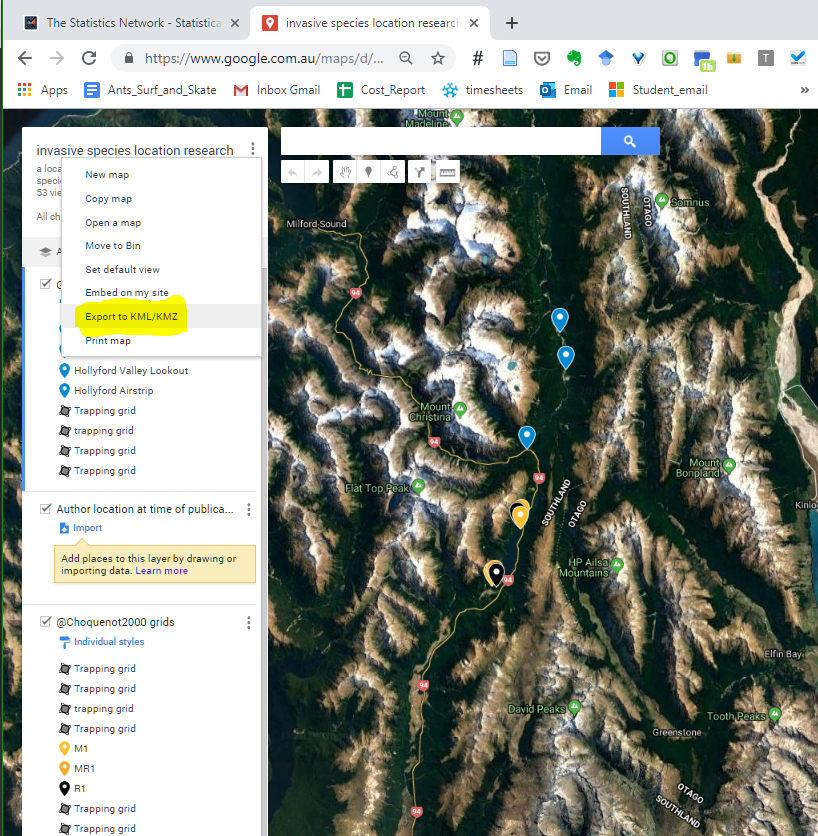
- Add
.zipto.kmlfile - Unzip renamed file (as per normal in windows)
- Change the file extention to
kmz - Import correct file sections using the following code:
##librares needed
library(rgdal)
library(tidyverse)
library(ggplot2)
```{r kmzKml} nc <- st_read(system.file(“shape/nc.shp”, package=”sf”), quiet = TRUE)
limit to first 2 counties
nc <- nc[1:2,]
convert to SpatialPolygonsDataFrame
nc_sp <- as(nc, “Spatial”)
file <- “data/Canberra-Transit.kmz/doc.kml”
?readOGR SST_start = readOGR(file)
OGR data source with driver: LIBKML
Source: “Burrows_et_al_Nature_traj_ocean_NH1.kmz”, layer: “SST_start”
with 42205 features
It has 12 fields
SST_1 = readOGR(file,”SST_1”) OGR data source with driver: LIBKML Source: “Burrows_et_al_Nature_traj_ocean_NH1.kmz”, layer: “SST_1” with 7719 features It has 12 fields ```
My notes
Found in stack comments here